
Do you know your swales from your culverts?
- paulstevens24

- Jun 24, 2022
- 5 min read
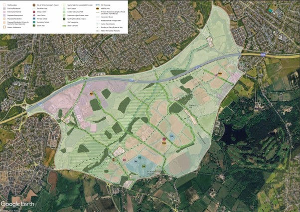
A lot has been going on “behind the scenes” with the University of Reading (owners of the largest part of the land along the Loddon Valley at Hall Farm) inviting SOLVE Hall Farm to join them for a meeting to discuss our “Alternative vision for Hall Farm”. The meeting is now set for 7th July and a few of us have met online to discuss our strategy and whether the document needs any revising.
Key updates to the document include the removal of references to the “nascent city of Reading” (In case you missed it Reading failed in its bid to become a City), and the inclusion of Flood Management as one of the more significant environmental improvements that could potentially benefit the wider Loddon Valley community.
One of the challenges I personally have to meet is to continually update my knowledge of subjects outside my everyday experience. Fortunately, as a retired teacher, “swotting up” on a subject is something I have had to practice many times, so here is my attempt at explaining how “re-profiling” the landscape at Hall Farm could take flood water off line and add to the environmental enrichment we are already promoting to the University.
First, the answer to the question posed above is:
“Drainage swales are shallow ditches that blend in with surrounding landscape design, facilitate water management, and encourage natural irrigation. Swales take advantage of natural slopes in the land to direct water downward into all the soil as opposed to letting it pool above ground or waterlog a specific region. Property owners can make use of these self-sufficient, permaculture storm drains, particularly if they live in wetland areas”.
“A culvert is a closed conduit or tunnel used to convey water from one area to another, normally from one side of a road to the other side. Typically culverts are box shaped, round or elliptical in cross section. They are often pre-fabricated and can be made from pipes, reinforced concrete or other materials that are embedded within the surrounding landscape to create a bridge-like structure that permits the stable and proper flow of water under an obstacle such as a road, and can help alleviate flooding and reduce erosion”.
So swales and culverts can both be used to help to “manage” flood waters. But experience of flood management schemes in other areas of the country have shown that so called "flood defences" can also create problems elsewhere, with embankments and dredging for example, simply pushing the flooding further downstream.
However, the good news is that much can be done to restore and enhance natural flood processes which not only alleviate flood risks but can also have many other environmental benefits. The "rewilding" movement has seen exponential growth across the country and for good reason, it offers hope for a more sustainable future where we make more room for nature, with benefits for us, our environment and even our economy. The rewilding Britain website is well worth a visit and I quote extensively from their blog on natural flood management.
“Flooding costs the UK economy more than £1 billion annually – a figure that rises to nearer £5 billion in a bad year. Traditional approaches to flood defence focus on managing flood risk using hard defences such as floodwalls and river revetments. While mitigating some of the worst consequences of flooding, these do little to challenge underlying causes – and when they fail, the consequences can be devastating.
Managing flood risk naturally through rewilding can be cheaper and more sustainable. Rewilding – which includes the restoration of woodlands and wetlands and even the reintroduction of the beaver – can substantially reduce flood risk downstream.
Rewilding tackles this sort of issue by helping natural processes work. For example, tree roots stretch deep into the ground increasing water filtration rates. Natural processes can protect communities at a fraction of the cost of traditional flood defences.
And of course, it’s about more than just flooding. Rewilding can improve water quality and stimulate the revival of vibrant ecosystems rich in wildlife. It can create healthy natural landscapes that help to stimulate tourism and ecological awareness, while soaking up greater quantities of carbon”.
The river Loddon at Hall Farm is already a great example of natural flood defence. It has many fallen trees creating leaky dams that slow the flow of water downstream and allow the surrounding water meadows more time to absorb flooding when it occurs. The natural flood defences offered by the existing flood plains could be further improved and enhanced by adding a number of additional “natural” measures. These are covered in some detail in the booklet linked below and I have extracted a few key paragraphs that seem appropriate to the land at Hall Farm.
“Well-sited and well-managed floodplain and riparian woodland can contribute to the delivery of a host of outcomes. They provide important wildlife habitat and increased canopy shade and shelter for water-based flora and fauna. They can also provide shelter and shade for livestock and prevent damage to crops and soil erosion. Trees absorb and lock up carbon thus helping to reduce net carbon emissions, while riparian woodland can stabilise banks and help prevent excessive deposition of sediment instream. Strategically placed woodland can also reduce diffuse pollution by intercepting pollutant laden runoff”.
“Land management measures are land based techniques and practices that seek to influence flood generation by reducing the amount of surface runoff reaching the river network. They achieve this primarily by improving soil structure (e.g. making it more porous), increasing infiltration, and ultimately increasing the capacity of the land to store water. In addition to reducing runoff, these measures can also reduce soil erosion and the transfer of sediment and pollutants to rivers”.
“Wetlands can be viewed as areas of water storage in the landscape that can help to reduce the impacts of flooding and drought by slowing and holding flood water and then releasing this water during drier times. In addition to aiding flood prevention, wetlands can improve water quality by trapping sediments and retaining excess nutrients and pollutants. They are often highly productive ecosystems that support a diverse array of habitats and species and some wetlands, particularly peatlands, are effective in storing carbon, thus helping to mitigate the effects of climate change”.
“Washlands and offline storage ponds are areas next to a river or stream where flood water is directed at times of high flow. Typically, water is diverted and temporarily stored in purpose-designed areas of the floodplain where there is sufficient area for storage. These storage areas then drain back out into the watercourses after the main flood peak has passed downstream, usually via a controlled outlet. By diverting a proportion of the peak river flow out of the channel and into an offline pond or washland, a proportion of the flood flow can be attenuated”.
As locals many of us know that Shinfield is named after the shining fields that are the flood plains of the River Loddon. Our task now is to persuade the University that the potential long term benefits to the environment at Hall Farm outweigh the short term benefits of selling the land for housing development.
No mean feat when the developers are allegedly offering an eye watering £500,000,000 in return for the proposed 4,500 houses.


Comments