Green belt or grey belt - another option for WBC?
- paulstevens24

- May 19, 2024
- 3 min read

We’re told WBC will soon produce its Local Growth Plan update, probably just around the time of the school holidays, when many people will have their mind on other things (coincidence, surely?). The Planning Inspectorate will judge the plan for soundness, probably some time in 2025. By then a Labour government will almost inevitably be in power, and we learned recently of how it plans to deal with the national housing crisis. A key policy will be to free up what Labour refer to as the ‘grey belt’. Their press release of 19th April talks of giving up parts of the Green Belt that are “poor quality land, car parks, and wasteland”. Keir Starmer referred in an interview given just before its release to "poor-quality scrubland, mothballed on the outskirts of town”.
Research by the estate agents Knight Frank has found thousands of such sites across the country. They include dozens of potential locations in the northern parishes of Wokingham Borough; (https://urbanistarchitecture.co.uk/resources/green-belt-map/). The actual locations of the sites are not listed on the website, but aerial photographs provided by Google Maps give us a starting point, offering some indication of land use. So let’s look at Green Belt land in Wokingham Borough that might relate to Labour’s ‘grey belt’ concept.
The so-called Metropolitan Green Belt covers most of the borough’s northern parishes. It effectively includes everything from a line drawn between Twyford, along the B3018 Waltham Road, to the borough boundary with Maidenhead & Windsor, which runs roughly north to south from the Thames east of Aston, then east of Cockpole Green and Hare Hatch, then past Shurlock Row down to the M4.
What sort of land does it include? There is extensive woodland between Crazies Hill, Warren Row, and Knowl Hill (the last two in the borough of Maidenhead and Windsor). The only substantial woodland elsewhere is along the East bank of the Thames between Remenham and Wargrave. Otherwise the northern parishes’ land surface mainly consists of ploughland. However, there are areas which appear to be out of agricultural use and are not extensive woodland.

One is between the A130 and Crazies Hill. The picture above, from Google Streetview, illustrates the type of land in the area.
Another lies between Ruscombe and Hare Hatch, where between the B3024 and the B3018, and then South of the M4 there are - to judge by the evidence of Google Streetview, illustrated below - areas of what appears to be scrubland adjacent to existing settlement. These pictures are no more than illustrative, and may or may not be among the sites that Knight Frank identified. They are intended merely to give some idea of land use in the northern parishes of the borough which have so far been exempt from housing development. Not all of it is best quality agricultural land: we see parts that look like what Labour spokespeople refer to as ‘poor-quality scrubland’.

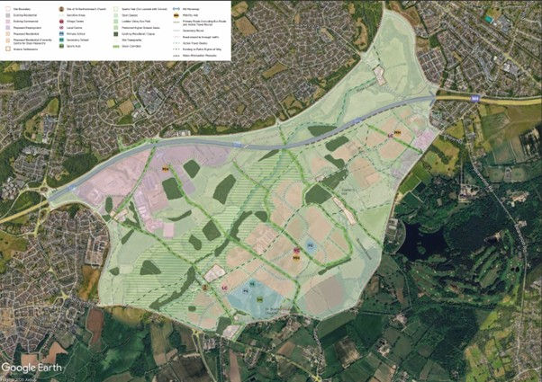
If our local authority went for a slightly broader definition of grey belt, to include an unattractive expanse of ploughland between an A road and a railway line, it could consider a larger site between Ruscombe and Hare Hatch. This lies north of the railway line outside Twyford. Developers Berkeley Homes have proposed a 2,500 home development here, given the name ‘Twyford Gardens’. A major advantage of developing this site is its proximity to the Elizabeth Line rail station at Twyford, in addition to the good road connections nearby allowing ready access to and from major transport arteries, the A4 and M4.

Regardless of particular sites, the general point has recently been made very well by a director at the development planning firm Boyer: “The most sustainable locations for housing development, close to job opportunities and amenities, remain untouched within the Green Belt, while development sprawls out into less sustainable areas in the open countryside.”
How long will WBC be content to let that remain the case in our borough?
How long do the Council Executive members think they can get away with letting developers build where they want, in locations that inflict on residents massive problems of access, traffic congestion, lack of infrastructure etc? Labour has set out a clear alternative approach to planning where housing development can go in future. Let’s hope that WBC, who for years have claimed they have to follow what government says, is taking it seriously.
Or will Stephen Conway and his colleagues inflict on us another ‘social and environmental disaster’ (I quote 2023 LibDem election literature) by approving thousands of houses at Hall Farm before Labour get into power?
Pat Phillipps


Comments